Storm Boelo Threatens Northern Britain With High Winds
A second named storm of the season brings intense gusts and rain to the north, following a period of extreme heat and wildfires.
By Malik Salazar ·
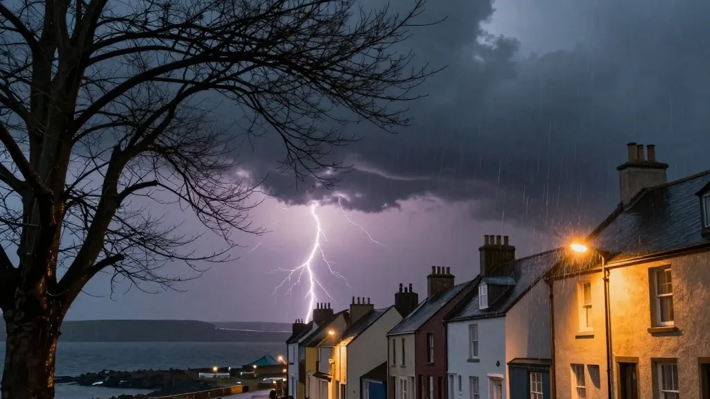
A significant tension exists between the fragile recovery from the summer's record heat and the arrival of severe autumn weather as Storm Boelo approaches the northern reaches of the United Kingdom. This second named storm of the season is expected to deliver powerful gusts and persistent precipitation, creating a challenging environment for infrastructure and residents alike. The primary concern lies in the potential for widespread disruption to travel networks and a recurrence of the power outages that recently affected the south of the country.
The meteorological context has shifted rapidly over the last few days. On Friday, Storm Austen impacted the south-west of England before moving eastward. Now, Boelo is tracking into the region, bringing heavy and frequent showers to northern areas. The Met Office has classified the situation with an amber warning, which is the second highest level of alert. This specific warning applies to Scotland and the northern part of England, extending south to Carlisle, from 9 pm on Saturday until 9 pm on Sunday. A distinct amber warning is in place for the north-east of Northern Ireland, covering the period from 9 pm Saturday to 10 am Sunday.
Broader warnings are also active across the region. A large yellow warning for wet and windy conditions covers the entire northern UK from midday Saturday through to 9 pm Sunday. Additionally, a separate alert for heavy rain affects Wales and sections of western and southern England from 11 am to 11 pm on Saturday. The forecasting agency has advised the public to remain indoors whenever possible, highlighting the risks posed by flying debris and powerful waves that could endanger those caught outside.
Transport operators are bracing for significant interruptions. Ferry and rail services face widespread delays and cancellations. TransPennine Express has recommended that passengers avoid all non-essential journeys on both Saturday and Sunday. Similarly, Avanti West Coast has issued a strong advisory against traveling north of Preston on Sunday, citing the severity of the expected conditions.
The energy sector is also on high alert. The Met Office has warned that the power cuts experienced in the south-west may be replicated in the amber warning zones in the north. During the previous storm, 31,000 homes in the south-west lost electricity. By Saturday morning, more than 3,700 homes in that region remained without power, according to the National Grid map. This precedent has raised concerns about the resilience of the northern grid systems.
Alex Burkill, a meteorologist at the Met Office, identified wind as the primary hazard. He noted that strong, gusty winds would sweep across Northern Ireland, northern England, and Scotland throughout the day, intensifying as evening approached. Although temperatures are expected to be slightly above the seasonal norm, the combination of wind and rain will create a perception of significant cold. Burkill described the conditions as quite unpleasant, marking a sharp contrast to the milder weather that has characterized much of the current autumn season.
The peak wind speeds, which may exceed 80 mph, are forecast for Saturday evening. While the wet weather is expected to clear overnight in many parts of the country, Scotland and Northern Ireland will continue to face additional rainfall. This event follows a year marked by extreme climatic variations. Human-driven climate change is altering global rainfall patterns, and the UK recently experienced its hottest summer on record, which included five distinct heatwaves and a record 40 days with temperatures above 30 degrees Celsius.
Political attention has also turned to the shifting weather patterns. At a summit discussing the summer's record-breaking wildfires on Friday, Prime Minister Andy Burnham warned that the nation could face a winter of increased flooding. While he rejected the notion that the government is lagging in civil preparedness, he acknowledged that the country is operating in an environment where unexpected events are becoming increasingly frequent.
As the storm system makes landfall, the focus shifts to the immediate impact on the north. The convergence of high winds, heavy rain, and potential power failures presents a complex challenge for emergency services and residents. The coming hours will determine the extent of the disruption and whether the infrastructure can withstand the second major storm of the season.